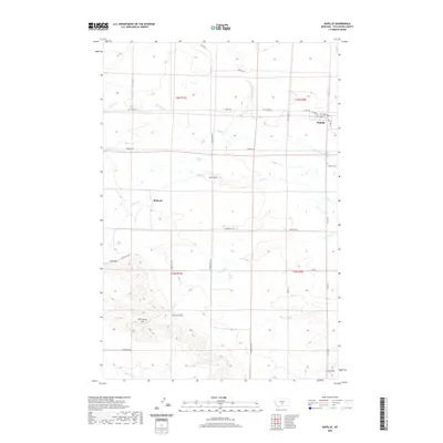
2020 Map of Rapelje
USGS Topo · Published 2020About this map
The small community of Rapelje serves as the focal point of this rural Stillwater County landscape, which transitions from the flat expanse of the Lake Basin into a series of rising landforms to the south. Historically significant landmarks such as Hugh Henry Hill, Jones Hill, and Love Hill rise above the drainage systems of Gurney Cr and McNally Cr, offering a detailed view of the regional topography that has long shaped local ranching and settlement patterns.
Find a feature on this map
36 named features on this map. Tap any name to fly to it.
Don’t see what you’re looking for? This feature index may not catch every label — zoom into the map to look around manually.
Map Details
Editions of this 2020 Rapelje Map
This is the sole edition of this map. No revisions or reprints were ever made.
Other maps of this area

1889 · Big Snowy Mountain
USGS Topo · 1:250,000

1892 · Stillwater
USGS Topo · 1:125,000

1893 · Big Snowy Mountain
USGS Topo · 1:250,000

1954 · Billings
USGS Topo · 1:250,000

1954 · Roundup
USGS Topo · 1:250,000

1955 · Antelope Point
USGS Topo · 1:24,000

1955 · Russell Gulch
USGS Topo · 1:24,000

1956 · Rapelje
USGS Topo · 1:24,000

1956 · Battle Butte
USGS Topo · 1:24,000

1956 · Lindemulder Hill
USGS Topo · 1:24,000