
1953 Map of Rapid City West
USGS Topo · Published 1955About this map
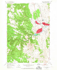
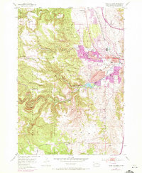
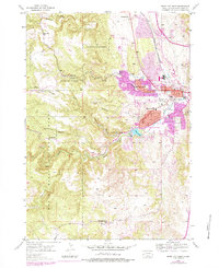
Black Hills National Forest dominates the western landscape of this mid-century survey, where the rugged terrain of the Black Hills meets the expanding edges of Rapid City. The map reveals a community structured around its natural hydrology and early institutional development, with Rapid Creek flowing through the heart of the area and feeding into Canyon Lake. A distinct network of rural and early suburban schools, such as Red Brick Sch and Doty Sch, indicates the distributed settlement patterns of the 1950s.
Find a feature on this map
38 named features on this map. Tap any name to fly to it.
Don’t see what you’re looking for? This feature index may not catch every label — zoom into the map to look around manually.
Map Details
Editions of this 1953 Rapid City West Map
4 editions found
Other maps of this area

1893 · Rapid
USGS Topo · 1:125,000

1894 · Hermosa
USGS Topo · 1:125,000

1898 · Rapid
USGS Topo · 1:125,000

1901 · Hermosa
USGS Topo · 1:125,000

1903 · Rapid
USGS Topo · 1:125,000

1953 · Hermosa NW
USGS Topo · 1:24,000

1953 · Blackhawk
USGS Topo · 1:24,000

1953 · Rapid City East
USGS Topo · 1:24,000

1953 · Piedmont
USGS Topo · 1:24,000

1953 · Rapid City NW
USGS Topo · 1:24,000
Featured Places
- Rapid City, SD
- South Canyon Country Estates, SD
- Clarkson Addition, SD
- Schaeferville, SD
- Wildwood Addition, Rapid City