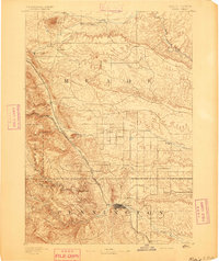
1893 Map of Rapid
USGS Topo · Published 1893About this map
Fort Meade stands at the foot of the hills in this early 1890s survey, marking a significant military presence in the region. The landscape transitions from the high peaks of the Black Hills into the plains of Meade and Pennington counties. The development of the area is tied closely to the rail lines, with the Fremont Elkhorn and Missouri Valley Railroad and the Black Hills and Fort Pierre Railroad cutting through the terrain. These tracks connected emerging settlements like Tilford, Piedmont, and Blackhawk. Near the burgeoning town of Rapid, an Indian School and Canyon Lake are documented, while the outlying territories show isolated agricultural interests such as Doe Butte Ranch and Grashull. To the north, the prominent volcanic laccolith of Bear Butte serves as a stark landmark overlooking Bear Butte Creek.
Find a feature on this map
29 named features on this map. Tap any name to fly to it.
Don’t see what you’re looking for? This feature index may not catch every label — zoom into the map to look around manually.
Map Details
Editions of this 1893 Rapid Map
2 editions found
Other maps of this area

1893 · Rapid
USGS Topo · 1:125,000

1894 · Deadwood
USGS Topo · 1:125,000

1894 · Hermosa
USGS Topo · 1:125,000

1896 · Harney Peak
USGS Topo · 1:125,000

1898 · Rapid
USGS Topo · 1:125,000

1899 · Sturgis
USGS Topo · 1:62,500

1901 · Hermosa
USGS Topo · 1:125,000

1901 · Harney Peak
USGS Topo · 1:125,000

1901 · Deadwood
USGS Topo · 1:125,000

1903 · Rapid
USGS Topo · 1:125,000