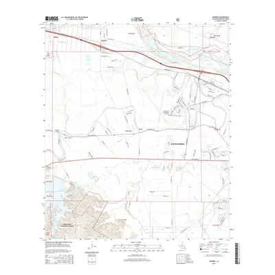
2015 Map of Rapides
USGS Topo · Published 2015About this map
Alexandria and the surrounding river bottomlands are captured here in a period of modern expansion along the Red River. The landscape is defined by its complex drainage network, where names like Alligator Slough, Tiger Bayou, and Irish Pitch Number One speak to the heritage of the Louisiana wetlands. While the urban footprint of the city and its Alexandria International Airport dominates the eastern section, the western portion of the map transitions into the wooded elevations of the Kisatchie National Forest. This intersection of managed timberland and alluvial plains reveals a pattern of settlement tied closely to the water, from the small clusters at Rapides and Alfalfa to the historic Belgard Bend. Features such as Kincaid Reservoir and the Lamothe Bridge highlight the engineering required to navigate and utilize this water-rich environment.
Find a feature on this map
119 named features on this map. Tap any name to fly to it.
Don’t see what you’re looking for? This feature index may not catch every label — zoom into the map to look around manually.
Map Details
Editions of this 2015 Rapides Map
This is the sole edition of this map. No revisions or reprints were ever made.
Other maps of this area

1932 · Boyce NE
USGS Topo · 1:31,680

1932 · Boyce SW
USGS Topo · 1:31,680

1935 · Lecompte
USGS Topo · 1:62,500

1941 · Alexandria
USGS Topo · 1:62,500

1941 · Boyce
USGS Topo · 1:62,500

1945 · Boyce SE
USGS Topo · 1:31,680

1949 · Boyce NW
USGS Topo · 1:31,680

1949 · Boyce SE
USGS Topo · 1:31,680

1953 · Alexandria
USGS Topo · 1:250,000

1955 · Alexandria
USGS Topo · 1:250,000