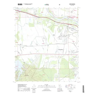
2018 Map of Rapides
USGS Topo · Published 2018About this map
Alexandria and its northwestern environs are defined by the convergence of the Red River and a dense network of bayous and drainage canals. The landscape transitions from the developed grids near the Alexandria International Airport to the managed timberlands and hills of the Kisatchie National Forest. Water management is a primary feature of the region, evidenced by infrastructure like Irish Ditch Number One, Irish Ditch Number Two, and the expansive Kincaid Reservoir at the southwestern edge. Smaller rural settlements such as Alfalfa and Barrett anchor the northern reaches, while several bayous, including Bayou Rapides and Persimmon Bayou, snake through the floodplains. The map also documents historical local sites like Newlight Cem and Belgard Cem, providing valuable location data for genealogical research in Rapides Parish.
Find a feature on this map
115 named features on this map. Tap any name to fly to it.
Don’t see what you’re looking for? This feature index may not catch every label — zoom into the map to look around manually.
Map Details
Editions of this 2018 Rapides Map
This is the sole edition of this map. No revisions or reprints were ever made.
Other maps of this area

1932 · Boyce NE
USGS Topo · 1:31,680

1932 · Boyce SW
USGS Topo · 1:31,680

1935 · Lecompte
USGS Topo · 1:62,500

1941 · Alexandria
USGS Topo · 1:62,500

1941 · Boyce
USGS Topo · 1:62,500

1945 · Boyce SE
USGS Topo · 1:31,680

1949 · Boyce NW
USGS Topo · 1:31,680

1949 · Boyce SE
USGS Topo · 1:31,680

1953 · Alexandria
USGS Topo · 1:250,000

1955 · Alexandria
USGS Topo · 1:250,000