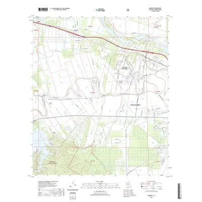
2020 Map of Rapides
USGS Topo · Published 2020About this map
The Red River forms the geographic backbone of this survey, winding through the alluvial plains of Alexandria and the surrounding bayou country. The landscape is defined by an intricate network of waterways including Sandy Bayou, Big Bayou, and Tiger Bayou, reflecting the complex drainage patterns of the region. A significant portion of the western territory is occupied by the Kisatchie National Forest, featuring the large Kincaid Reservoir and several landmarks such as Kincaid Bridge.
Find a feature on this map
122 named features on this map. Tap any name to fly to it.
Don’t see what you’re looking for? This feature index may not catch every label — zoom into the map to look around manually.
Map Details
Editions of this 2020 Rapides Map
This is the sole edition of this map. No revisions or reprints were ever made.
Other maps of this area

1932 · Boyce NE
USGS Topo · 1:31,680

1932 · Boyce SW
USGS Topo · 1:31,680

1935 · Lecompte
USGS Topo · 1:62,500

1941 · Alexandria
USGS Topo · 1:62,500

1941 · Boyce
USGS Topo · 1:62,500

1945 · Boyce SE
USGS Topo · 1:31,680

1949 · Boyce NW
USGS Topo · 1:31,680

1949 · Boyce SE
USGS Topo · 1:31,680

1953 · Alexandria
USGS Topo · 1:250,000

1955 · Alexandria
USGS Topo · 1:250,000