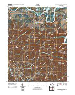
2010 Map of Rappahannock Academy
USGS Topo · Published 2010About this map
The Rappahannock River winds through this rural landscape of Spotsylvania County, defined by its historic river bends and numerous small settlements known as corners. This 2010 survey highlights a pattern of local commerce and navigation established long ago, with sites like Hayfield Wharf and Moons Mount Wharf marking the shoreline, and Garretts Store serving the interior. The landscape is dotted with family-named nodes such as Skinkers Corner, Raines Corner, and Bullocks Corner, which often emerged at the intersections of local transit routes like Burma Rd and Jeb Stuart Rd. In the southern reaches, the geography shifts toward small-scale industry and community life, evidenced by the Travis Mill on Travis Lake and the Bethesda Church. The map provides a detailed view of the water system, from the Farleyvale Reach to the complex network of creeks including Goldenvale Creek and Ware Creek.
Find a feature on this map
97 named features on this map. Tap any name to fly to it.
Don’t see what you’re looking for? This feature index may not catch every label — zoom into the map to look around manually.
Map Details
Editions of this 2010 Rappahannock Academy Map
This is the sole edition of this map. No revisions or reprints were ever made.
Other maps of this area

1889 · Fredericksburg
USGS Topo · 1:125,000

1892 · Fredericksburg
USGS Topo · 1:125,000

1894 · Fredericksburg
USGS Topo · 1:125,000

1926 · Stafford
USGS Topo · 1:62,500

1931 · Stafford
USGS Topo · 1:62,500

1942 · Bowling Green
USGS Topo · 1:31,680

1942 · Upper Zion
USGS Topo · 1:31,680

1942 · Woodford
USGS Topo · 1:31,680

1942 · Guinea
USGS Topo · 1:31,680

1942 · Port Royal
USGS Topo · 1:31,680