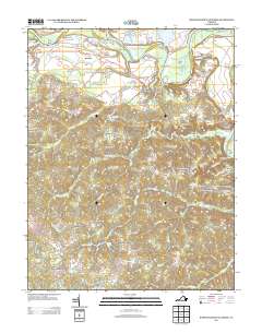
2013 Map of Rappahannock Academy
USGS Topo · Published 2013About this map
The Rappahannock River dictates the character of this landscape, its winding course marked by historical navigation points like Hayfield Wharf and Moons Mount Wharf. The river's serpentine bends create distinct landforms such as Corbins Neck and Devils Woodyard Turn, while the surrounding interior is defined by a dense network of crossroad settlements and family-named landmarks. The presence of Rappahannock Academy and Bethesda Church suggests established community centers that have anchored this part of Virginia for generations. The transition from the river lowlands to the higher ground is noted by features like Taliaferro Mount and Fish Hook Lake. This terrain is interlaced with numerous small branches and creeks, including Goldenvale Cr and Ware Cr, which historically supported local industry as evidenced by Travis Mill. A series of named corners, from Skinkers Corner to Bullocks Corner, traces the evolution of local road networks and property lines along the Tidewater Trl.
Find a feature on this map
110 named features on this map. Tap any name to fly to it.
Don’t see what you’re looking for? This feature index may not catch every label — zoom into the map to look around manually.
Map Details
Editions of this 2013 Rappahannock Academy Map
This is the sole edition of this map. No revisions or reprints were ever made.
Other maps of this area

1889 · Fredericksburg
USGS Topo · 1:125,000

1892 · Fredericksburg
USGS Topo · 1:125,000

1894 · Fredericksburg
USGS Topo · 1:125,000

1926 · Stafford
USGS Topo · 1:62,500

1931 · Stafford
USGS Topo · 1:62,500

1942 · Bowling Green
USGS Topo · 1:31,680

1942 · Upper Zion
USGS Topo · 1:31,680

1942 · Woodford
USGS Topo · 1:31,680

1942 · Guinea
USGS Topo · 1:31,680

1942 · Port Royal
USGS Topo · 1:31,680