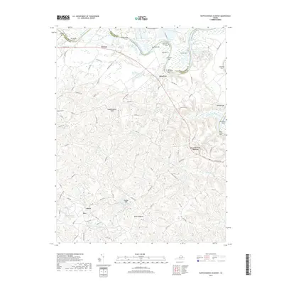
2019 Map of Rappahannock Academy
USGS Topo · Published 2019About this map
The Rappahannock River dictates the landscape of this region, winding through a series of dramatic reaches and bends including Mill Reach, Farleyvale Reach, and the Devils Woodyard Turn. Along the riverbanks, distinct landmarks like Moss Neck Bar and Snowden Bar reveal the shifting hydrology of the Stafford and Caroline county lines. Inland, the settlement of Rappahannock Academy serves as a focal point for a rural network of roads like Tidewater Trl and Jeb Stuart Rd. The area is marked by numerous small communities and family-named features, such as Featherstone Fork and Travis Mill, which sit among a complex system of tributaries like Goldenvale Cr and Mount Creek. This documentation of the late 2010s shows a landscape still defined by its historical plantation and academy roots, where topographic features like Talliaferro Mt rise above the swampy lowlands of Mount Swamp.
Find a feature on this map
64 named features on this map. Tap any name to fly to it.
Don’t see what you’re looking for? This feature index may not catch every label — zoom into the map to look around manually.
Map Details
Editions of this 2019 Rappahannock Academy Map
This is the sole edition of this map. No revisions or reprints were ever made.
Other maps of this area

1889 · Fredericksburg
USGS Topo · 1:125,000

1892 · Fredericksburg
USGS Topo · 1:125,000

1894 · Fredericksburg
USGS Topo · 1:125,000

1926 · Stafford
USGS Topo · 1:62,500

1931 · Stafford
USGS Topo · 1:62,500

1942 · Bowling Green
USGS Topo · 1:31,680

1942 · Upper Zion
USGS Topo · 1:31,680

1942 · Woodford
USGS Topo · 1:31,680

1942 · Guinea
USGS Topo · 1:31,680

1942 · Port Royal
USGS Topo · 1:31,680