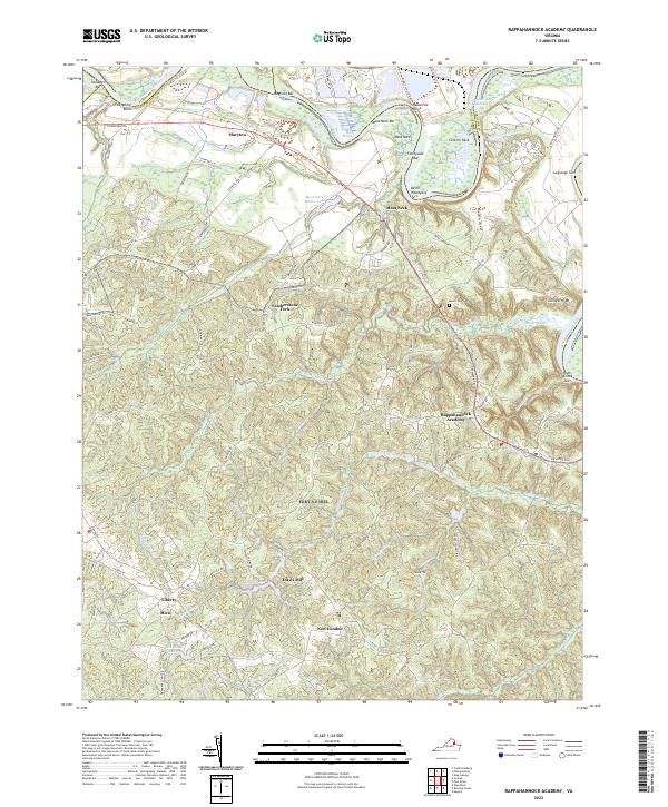
2022 Map of Rappahannock Academy
USGS Topo · Published 2022About this map
Rappahannock Academy serves as the focal point for this section of Caroline County, situated at a junction near Mount Dew Cem. The landscape is defined by the winding course of the Rappahannock River, where numerous navigational reaches and bends like Milk Reach and Fox Spring Bend trace the boundary with Stafford and King George counties. The river-dominated northern edge gives way to a complex network of internal drainages, including Ware Cr and Mount Cr, which carve through the terrain toward the south and east.
Find a feature on this map
91 named features on this map. Tap any name to fly to it.
Don’t see what you’re looking for? This feature index may not catch every label — zoom into the map to look around manually.
Map Details
Editions of this 2022 Rappahannock Academy Map
This is the sole edition of this map. No revisions or reprints were ever made.
Other maps of this area

1889 · Fredericksburg
USGS Topo · 1:125,000

1892 · Fredericksburg
USGS Topo · 1:125,000

1894 · Fredericksburg
USGS Topo · 1:125,000

1926 · Stafford
USGS Topo · 1:62,500

1931 · Stafford
USGS Topo · 1:62,500

1942 · Bowling Green
USGS Topo · 1:31,680

1942 · Upper Zion
USGS Topo · 1:31,680

1942 · Woodford
USGS Topo · 1:31,680

1942 · Guinea
USGS Topo · 1:31,680

1942 · Port Royal
USGS Topo · 1:31,680