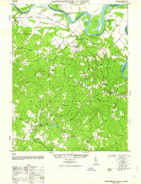
1964 Map of Rappahannock Academy
USGS Topo · Published 1964About this map
The A P Hill Military Reservation dominates this mid-century landscape, as military lands increasingly defined the geography of Caroline County. Within this tactical landscape, older residential and social patterns remain visible through established family estates like Moss Neck Manor and Santee, alongside communal anchors such as Bethesda Church and Liberty Church. The map details the transition from traditional river-bound economies toward modern infrastructure, featuring the Moss Neck Airstrip and numerous road intersections like Bullocks Corner and Skinkers Corner.
Find a feature on this map
45 named features on this map. Tap any name to fly to it.
Don’t see what you’re looking for? This feature index may not catch every label — zoom into the map to look around manually.
Map Details
Editions of this 1964 Rappahannock Academy Map
This is the sole edition of this map. No revisions or reprints were ever made.
Other maps of this area

1889 · Fredericksburg
USGS Topo · 1:125,000

1892 · Fredericksburg
USGS Topo · 1:125,000

1894 · Fredericksburg
USGS Topo · 1:125,000

1926 · Stafford
USGS Topo · 1:62,500

1931 · Stafford
USGS Topo · 1:62,500

1942 · Bowling Green
USGS Topo · 1:31,680

1942 · Upper Zion
USGS Topo · 1:31,680

1942 · Woodford
USGS Topo · 1:31,680

1942 · Guinea
USGS Topo · 1:31,680

1942 · Port Royal
USGS Topo · 1:31,680