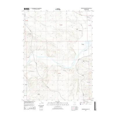
2014 Map of Rasmussen Hollow
USGS Topo · Published 2014About this map
Green River meanders sharply through the center of this terrain, carving the dramatic landmark known as Horseshoe Bend. To the northeast, the settlement of Jensen sits near the confluence of Ashley Creek and the river, marking a gateway into the agricultural expanse of Ashley Valley. This landscape is defined by its industrial and topographic features, including the prominent Asphalt Ridge and several named drainages like Rasmussen Hollow, Spring Hollow, and Walker Hollow.
Find a feature on this map
33 named features on this map. Tap any name to fly to it.
Don’t see what you’re looking for? This feature index may not catch every label — zoom into the map to look around manually.
Map Details
Editions of this 2014 Rasmussen Hollow Map
This is the sole edition of this map. No revisions or reprints were ever made.
Other maps of this area

1885 · Ashley
USGS Topo · 1:250,000

1907 · Jensen
USGS Topo · 1:125,000

1910 · Jensen
USGS Topo · 1:125,000

1917 · Vernal
USGS Topo · 1:125,000

1954 · Vernal
USGS Topo · 1:250,000

1958 · Vernal
USGS Topo · 1:250,000

1960 · Vernal
USGS Topo · 1:250,000

1964 · Vernal NE
USGS Topo · 1:24,000

1964 · Brennan Basin
USGS Topo · 1:24,000
1964 · Vernal SE
USGS Topo · 1:24,000