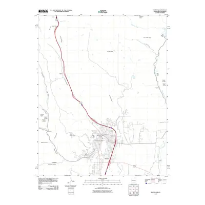
2010 Map of Raton
USGS Topo · Published 2010About this map
Raton serves as the focal point of this 2010 survey, positioned at the foot of the crucial Raton Pass. This northern New Mexico gateway is defined by a landscape of high mesas and deep canyons, including Bartlett Mesa and Railroad Canyon, which have historically shaped transportation routes into the state. The town's heritage is preserved within the Raton Downtown Historic District, while its industrial past is evidenced by a concentration of coal mining operations in the surrounding hills. Facilities like the Sugarite Number One Mine, Blossburg Number One Mine, and Gardiner Number One Mine point to the area's long-standing reliance on resource extraction. To the northeast, the terrain softens around Lake Maloya and Lake Alice, providing essential water infrastructure such as the Raton Water Works.
Find a feature on this map
60 named features on this map. Tap any name to fly to it.
Don’t see what you’re looking for? This feature index may not catch every label — zoom into the map to look around manually.
Map Details
Editions of this 2010 Raton Map
This is the sole edition of this map. No revisions or reprints were ever made.
Other maps of this area

1891 · Spanish Peaks
USGS Topo · 1:125,000

1892 · Elmoro
USGS Topo · 1:125,000

1893 · Spanish Peaks
USGS Topo · 1:125,000

1893 · Elmoro
USGS Topo · 1:125,000

1895 · Spanish Peaks
USGS Topo · 1:125,000

1897 · Elmoro
USGS Topo · 1:125,000

1897 · Spanish Peaks
USGS Topo · 1:125,000

1900 · Spanish Peaks
USGS Topo · 1:125,000

1912 · Raton
USGS Topo · 1:62,500

1914 · Raton
USGS Topo · 1:62,500