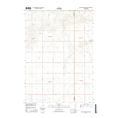
2015 Map of Rattlesnake Butte East
USGS Topo · Published 2015About this map
Rattlesnake Butte and the Buffalo Buttes dominate this high plains landscape along the border of Tripp and Gregory counties. This 2015 survey reveals a sparse, rural grid of section lines and gravel roads, including Daughters Rd, serving a community centered around landmark landmarks like Our Savior Cem. The drainage pattern is defined by the winding paths of Bull Creek and the West Branch Bull Creek, which carve through the undulating terrain of the northern Great Plains. These watercourses and their associated draws dictate the placement of local infrastructure and private landholdings in this part of South Dakota, where the Public Land Survey System remains the primary framework for local geography.
Find a feature on this map
27 named features on this map. Tap any name to fly to it.
Don’t see what you’re looking for? This feature index may not catch every label — zoom into the map to look around manually.
Map Details
Editions of this 2015 Rattlesnake Butte East Map
This is the sole edition of this map. No revisions or reprints were ever made.
Other maps of this area

1940 · Iona
USGS Topo · 1:62,500

1944 · Iona
USGS Topo · 1:62,500

1955 · Mitchell
USGS Topo · 1:250,000

1959 · Mitchell
USGS Topo · 1:250,000

1971 · Hamill SE
USGS Topo · 1:24,000

1971 · Colome
USGS Topo · 1:24,000

1971 · Dixon SW
USGS Topo · 1:24,000

1971 · Rattlesnake Butte East
USGS Topo · 1:24,000

1971 · Hamill
USGS Topo · 1:24,000

1971 · Rattlesnake Butte West
USGS Topo · 1:24,000