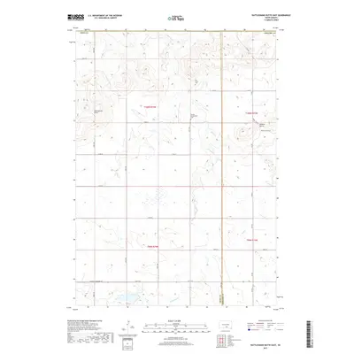
2017 Map of Rattlesnake Butte East
USGS Topo · Published 2017About this map
The Tripp and Gregory County line divides this prairie landscape, where the drainage of Bull Cr and its tributary W Br Bull Cr carve across the plains. Elevation is defined by prominent rises like Rattlesnake Butte and the Buffalo Buttes to the east, landmarks that provided essential orientation in a region of vast grazing lands and section-line roads. This rural South Dakota interior is anchored by two spiritual and genealogical sites, Our Savior Cem and the Miniska Presbyterian Cem, which stand as markers of the community’s Presbyterian and Lutheran heritage. Apart from S Dakota Highway 49 in the south, the area is navigated by a strict grid of gravel roads and avenues, such as 333 Ave and 277th St, reflecting the systematic settlement patterns of the Great Plains.
Find a feature on this map
33 named features on this map. Tap any name to fly to it.
Don’t see what you’re looking for? This feature index may not catch every label — zoom into the map to look around manually.
Map Details
Editions of this 2017 Rattlesnake Butte East Map
This is the sole edition of this map. No revisions or reprints were ever made.
Other maps of this area

1940 · Iona
USGS Topo · 1:62,500

1944 · Iona
USGS Topo · 1:62,500

1955 · Mitchell
USGS Topo · 1:250,000

1959 · Mitchell
USGS Topo · 1:250,000

1971 · Hamill SE
USGS Topo · 1:24,000

1971 · Colome
USGS Topo · 1:24,000

1971 · Dixon SW
USGS Topo · 1:24,000

1971 · Rattlesnake Butte East
USGS Topo · 1:24,000

1971 · Hamill
USGS Topo · 1:24,000

1971 · Rattlesnake Butte West
USGS Topo · 1:24,000