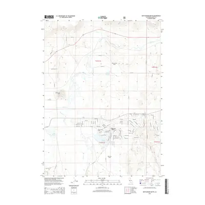
2015 Map of Rattlesnake Butte
USGS Topo · Published 2015About this map
California Pines is the central hub of this northern California landscape, centered around a dense residential street grid and the California Pines Airport. The surrounding terrain is defined by a series of water management features, including the Donovan Reservoir adjacent to the settlement, and more remote outposts like Kelly Reservoir and Signal Reservoir. The northern portion of the map is dominated by the Pit River and Hot Cr, which flow through the broad Warm Springs Valley. The grid of named roads such as Mission Rd, Padre Rd, and Cortez Rd reflects a planned residential layout that contrasts with the open spaces of Rye Grass Swale. To the west, the prominent Rattlesnake Butte provides a significant vertical landmark overlooking the river valley and the scattered spring locations like Mary Pete Spring.
Find a feature on this map
93 named features on this map. Tap any name to fly to it.
Don’t see what you’re looking for? This feature index may not catch every label — zoom into the map to look around manually.
Map Details
Editions of this 2015 Rattlesnake Butte Map
This is the sole edition of this map. No revisions or reprints were ever made.
Other maps of this area

1886 · Alturas
USGS Topo · 1:250,000

1892 · Alturas
USGS Topo · 1:250,000

1954 · Alturas
USGS Topo · 1:250,000

1958 · Alturas
USGS Topo · 1:250,000

1961 · Canby
USGS Topo · 1:62,500

1961 · Alturas
USGS Topo · 1:62,500

1962 · Alturas
USGS Topo · 1:250,000

1962 · Big Sage Reservoir
USGS Topo · 1:62,500

1962 · Jacks Butte
USGS Topo · 1:62,500

1965 · Alturas
USGS Topo · 1:250,000