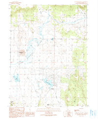
1990 Map of Rattlesnake Butte
USGS Topo · Published 1990About this map
The Warm Springs River and its meandering tributaries define the landscape of this high-desert region in Modoc County. Centered around the base of Rattlesnake Butte, the map documents a transition toward rural development and water management during the late 20th century. The southern portion of the sheet highlights the planned grid of the California Pines Airport vicinity, featuring infrastructure such as a Water Filtration Plant and the Delmorma School.
Find a feature on this map
29 named features on this map. Tap any name to fly to it.
Don’t see what you’re looking for? This feature index may not catch every label — zoom into the map to look around manually.
Map Details
Editions of this 1990 Rattlesnake Butte Map
This is the sole edition of this map. No revisions or reprints were ever made.
Other maps of this area

1886 · Alturas
USGS Topo · 1:250,000

1892 · Alturas
USGS Topo · 1:250,000

1954 · Alturas
USGS Topo · 1:250,000

1958 · Alturas
USGS Topo · 1:250,000

1961 · Canby
USGS Topo · 1:62,500

1961 · Alturas
USGS Topo · 1:62,500

1962 · Alturas
USGS Topo · 1:250,000

1962 · Big Sage Reservoir
USGS Topo · 1:62,500

1962 · Jacks Butte
USGS Topo · 1:62,500

1965 · Alturas
USGS Topo · 1:250,000