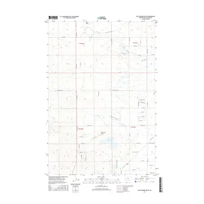
2017 Map of Rattlesnake Butte
USGS Topo · Published 2017About this map
Rattlesnake Butte stands as a prominent landmark in this section of Yellowstone County, overlooking a landscape defined by ranching infrastructure and intermittent watercourses. Near the settlement of Cline, the Rattlesnake Reservoir serves as a vital water source in an arid environment. The drainage patterns are clearly marked, with Twelve Mile Cr and Sevenmile Cr cutting through the terrain. The map reveals a high density of rural road names, many reflecting local families and land use, such as Homer Davis Rd, Osness Rd, and Haaland Rd. The presence of the Path To Cattle Feed Trl and BBWA Canal Access Roads emphasizes the region's agricultural focus, providing a detailed look at how land was divided and accessed in the early 21st century.
Find a feature on this map
58 named features on this map. Tap any name to fly to it.
Don’t see what you’re looking for? This feature index may not catch every label — zoom into the map to look around manually.
Map Details
Editions of this 2017 Rattlesnake Butte Map
This is the sole edition of this map. No revisions or reprints were ever made.
Other maps of this area

1893 · Huntley
USGS Topo · 1:125,000

1954 · Billings
USGS Topo · 1:250,000

1954 · Roundup
USGS Topo · 1:250,000

1956 · Rattlesnake Butte
USGS Topo · 1:24,000

1956 · Hickson Ranch
USGS Topo · 1:24,000

1956 · Huntley
USGS Topo · 1:24,000

1956 · Billings East
USGS Topo · 1:24,000

1957 · Billings
USGS Topo · 1:250,000

1957 · Billings West
USGS Topo · 1:24,000

1958 · Billings
USGS Topo · 1:250,000