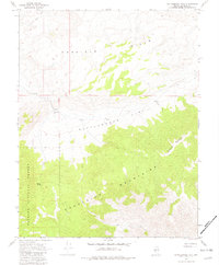
1967 Map of Rattlesnake Flat
USGS Topo · Published 1982About this map
Excelsior Mountains and the Garfield Hills dominate this mid-century topographic study of Mineral County, Nevada. The high desert landscape is defined by the broad expanse of Rattlesnake Flat, a basin where survival depended on water sources like Rattlesnake Well and Summit Spring. The western edge of the quadrangle includes a portion of the Toiyabe National Forest, showing the transition from open flats to protected timber and mountain terrain. Navigation through this remote environment in the late 1960s was limited to a few rugged routes, documented here as a Jeep Trail and a Pack Trail. These features suggest a landscape primarily used for ranching or mining access rather than permanent settlement, preserving the character of the Great Basin wilderness before modern development altered local tracks.
Find a feature on this map
11 named features on this map. Tap any name to fly to it.
Don’t see what you’re looking for? This feature index may not catch every label — zoom into the map to look around manually.
Map Details
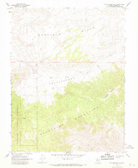
Editions of this 1967 Rattlesnake Flat Map
3 editions found
Other maps of this area

1909 · Hawthorne
USGS Topo · 1:250,000

1911 · Hawthorne
USGS Topo · 1:250,000

1915 · Hawthorne
USGS Topo · 1:250,000

1948 · Walker Lake
USGS Topo · 1:250,000

1955 · Powell Mtn
USGS Topo · 1:62,500

1957 · Walker Lake
USGS Topo · 1:250,000

1958 · Huntoon Valley
USGS Topo · 1:62,500

1962 · Walker Lake
USGS Topo · 1:250,000

1964 · Walker Lake
USGS Topo · 1:250,000

1967 · Pamlico
USGS Topo · 1:24,000