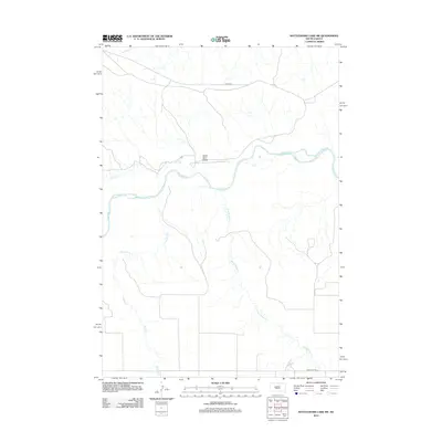
2012 Map of Rattlesnake Lake SW
USGS Topo · Published 2012About this map
The Cheyenne River winds through this central South Dakota landscape, defining the topography of Ziebach County as it flows eastward. This 2012 survey illustrates a sparse ranching and reservation environment where water dictates the naming of the land. Significant drainages like Bull Cr and Harding Cr converge toward the main river valley, while Black Bull Draw and Straighthead Cr mark the subtle elevation changes of the plains. Transportation is concentrated along a few key routes, primarily BIA Hwy 8 in the north and Singleton Rd in the south, reflecting the wide-open nature of the contemporary high plains where settlements are replaced by vast expanses of drainage basins and tribal lands.
Find a feature on this map
7 named features on this map. Tap any name to fly to it.
Don’t see what you’re looking for? This feature index may not catch every label — zoom into the map to look around manually.
Map Details
Editions of this 2012 Rattlesnake Lake SW Map
This is the sole edition of this map. No revisions or reprints were ever made.
Other maps of this area

1954 · Pierre
USGS Topo · 1:250,000

1955 · Rattlesnake Lake SE
USGS Topo · 1:24,000

1955 · Rattlesnake Lake SW
USGS Topo · 1:24,000

1955 · Rattlesnake Lake
USGS Topo · 1:24,000

1955 · Rattlesnake Lake NE
USGS Topo · 1:24,000

1955 · Bridger SE
USGS Topo · 1:24,000

1958 · Pierre
USGS Topo · 1:250,000

1982 · Bridger NE
USGS Topo · 1:24,000

1983 · Philip
USGS Topo · 1:100,000
1983 · Hartley
USGS Topo · 1:24,000