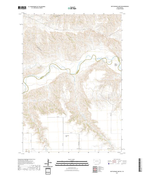
2021 Map of Rattlesnake Lake SW
USGS Topo · Published 2021About this map
The Cheyenne River cuts a deep, winding path through this western South Dakota landscape, marking the boundary between Ziebach and Haakon counties. The river's course is flanked by distinctive landforms, including the low-lying White Thunder Bottom and the expansive Milesville Flat to the south. This ranching territory is defined by a dense network of drainage draws and creeks, such as Straighthead Cr, Harding Cr, and Bull Cr, which reveal the erosional patterns typical of the region. A sparse grid of rural roads, including Milesville Rd, River Rd, and Bia HWY 8, connects the remote homesteads. The map illustrates the transition from the high prairie flats down to the breaks and bottoms of the river valley, offering a detailed look at the land's hydrology and topography.
Find a feature on this map
24 named features on this map. Tap any name to fly to it.
Don’t see what you’re looking for? This feature index may not catch every label — zoom into the map to look around manually.
Map Details
Editions of this 2021 Rattlesnake Lake SW Map
This is the sole edition of this map. No revisions or reprints were ever made.
Other maps of this area

1954 · Pierre
USGS Topo · 1:250,000

1955 · Rattlesnake Lake SE
USGS Topo · 1:24,000

1955 · Rattlesnake Lake SW
USGS Topo · 1:24,000

1955 · Rattlesnake Lake
USGS Topo · 1:24,000

1955 · Rattlesnake Lake NE
USGS Topo · 1:24,000

1955 · Bridger SE
USGS Topo · 1:24,000

1958 · Pierre
USGS Topo · 1:250,000

1982 · Bridger NE
USGS Topo · 1:24,000

1983 · Philip
USGS Topo · 1:100,000
1983 · Hartley
USGS Topo · 1:24,000