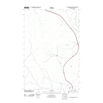
2011 Map of Rattlesnake Mountain
USGS Topo · Published 2011About this map
Rattlesnake Mountain dominates the landscape of this region in Lewis and Clark County, where cattle ranching and modern roadways intersect with high-altitude terrain. The presence of the Old Synnes Ranch and Old Thorne Ranch indicates a history of family-held agricultural land in the valleys south of the peaks, while Payne Camp suggests seasonal or specialized utility in the northern reaches. The area is defined by significant drainage systems including Clark Creek and Willow Creek, which carve through features like McLeod Basin. This topography is shaped by water and gravity, evidenced by the named Diamond Spring Gl and the steep descent of Sawmill Gulch. Modern connectivity is provided by routes such as Gates of the Mountain Rd and Toehead Rd, which traverse the lower elevations between Copper Butte and the surrounding ridgelines.
Find a feature on this map
18 named features on this map. Tap any name to fly to it.
Don’t see what you’re looking for? This feature index may not catch every label — zoom into the map to look around manually.
Map Details
Editions of this 2011 Rattlesnake Mountain Map
This is the sole edition of this map. No revisions or reprints were ever made.
Other maps of this area

1886 · Fort Logan
USGS Topo · 1:250,000

1889 · Helena
USGS Topo · 1:250,000

1893 · Helena
USGS Topo · 1:250,000

1899 · Helena
USGS Topo · 1:62,500

1899 · Helena
USGS Topo · 1:250,000

1903 · Helena
USGS Topo · 1:250,000

1947 · Butte
USGS Topo · 1:250,000

1948 · White Sulphur Springs
USGS Topo · 1:250,000

1950 · East Helena
USGS Topo · 1:62,500

1950 · Helena
USGS Topo · 1:62,500