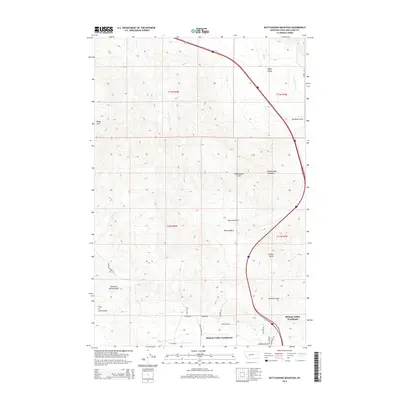
2014 Map of Rattlesnake Mountain
USGS Topo · Published 2014About this map
Helena Valley Northwest and Helena Valley Northeast occupy the southern portion of this landscape where the valley floor begins its ascent into the mountains. This 2014 survey captures the suburban expansion at the edge of the Helena area, where rural roads like Green Meadow Dr and Applegate Dr transition into the drainages of the Big Belt Mountains. To the north, the terrain becomes increasingly complex, dominated by peaks such as Rattlesnake Mountain and Baldy Mtn. The map preserves numerous local place names that hint at the region's prospecting and ranching history, including Trust-to-Luck Gulch, Copper Butte, and Diamond Spring Gulch. These features, along with several creek systems like Clark Cr and Ming Cr, define the drainage patterns flowing from the high country toward the settled valley below.
Find a feature on this map
33 named features on this map. Tap any name to fly to it.
Don’t see what you’re looking for? This feature index may not catch every label — zoom into the map to look around manually.
Map Details
Editions of this 2014 Rattlesnake Mountain Map
This is the sole edition of this map. No revisions or reprints were ever made.
Other maps of this area

1886 · Fort Logan
USGS Topo · 1:250,000

1889 · Helena
USGS Topo · 1:250,000

1893 · Helena
USGS Topo · 1:250,000

1899 · Helena
USGS Topo · 1:62,500

1899 · Helena
USGS Topo · 1:250,000

1903 · Helena
USGS Topo · 1:250,000

1947 · Butte
USGS Topo · 1:250,000

1948 · White Sulphur Springs
USGS Topo · 1:250,000

1950 · East Helena
USGS Topo · 1:62,500

1950 · Helena
USGS Topo · 1:62,500