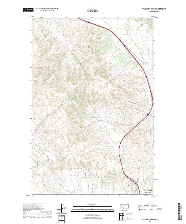
2024 Map of Rattlesnake Mountain
USGS Topo · Published 2024About this map
The rugged topography of the Big Belt Mountains foothills defines this landscape, where the northern fringe of Helena Valley Northeast meets a complex system of drainages and peaks. Elevation rises sharply from the valley floor toward landmarks like Baldy Mtn and Copper Butte, illustrating the dramatic vertical transition characteristic of the Lewis and Clark County wilderness. The network of intermittent streams, including Willow Creek and Beartooth Creek, has carved distinct landforms such as McLeod Basin and Towhead Gulch, which historically dictated the movement of travel and water through the region.
Find a feature on this map
26 named features on this map. Tap any name to fly to it.
Don’t see what you’re looking for? This feature index may not catch every label — zoom into the map to look around manually.
Map Details
Editions of this 2024 Rattlesnake Mountain Map
This is the sole edition of this map. No revisions or reprints were ever made.
Other maps of this area

1886 · Fort Logan
USGS Topo · 1:250,000

1889 · Helena
USGS Topo · 1:250,000

1893 · Helena
USGS Topo · 1:250,000

1899 · Helena
USGS Topo · 1:62,500

1899 · Helena
USGS Topo · 1:250,000

1903 · Helena
USGS Topo · 1:250,000

1947 · Butte
USGS Topo · 1:250,000

1948 · White Sulphur Springs
USGS Topo · 1:250,000

1950 · East Helena
USGS Topo · 1:62,500

1950 · Helena
USGS Topo · 1:62,500