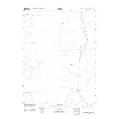
2012 Map of Rattlesnake Mountain
USGS Topo · Published 2012About this map
Strawberry Ranch and Eldridge Ranch serve as primary human landmarks in this high-desert region of White Pine County, where modern highway infrastructure meets traditional ranching terrain. The landscape is defined by the sharp rise of Rattlesnake Mountain and Cedar Mountain, overlooking the vast Diamond Valley. Water sources remain central to the geography here, with several named drainages and intermittent springs providing a vital network across the arid surface.
Find a feature on this map
13 named features on this map. Tap any name to fly to it.
Don’t see what you’re looking for? This feature index may not catch every label — zoom into the map to look around manually.
Map Details
Editions of this 2012 Rattlesnake Mountain Map
This is the sole edition of this map. No revisions or reprints were ever made.
Other maps of this area

1953 · Eureka
USGS Topo · 1:62,500

1956 · Ely
USGS Topo · 1:250,000

1957 · Buck Mountain
USGS Topo · 1:62,500

1957 · Diamond Springs
USGS Topo · 1:62,500

1957 · Cold Creek Ranch
USGS Topo · 1:62,500

1959 · Ely
USGS Topo · 1:250,000

1963 · Ely
USGS Topo · 1:250,000

1985 · Newark Lake
USGS Topo · 1:100,000
1990 · North of Eureka
USGS Topo · 1:24,000
1990 · Diamond Peak
USGS Topo · 1:24,000