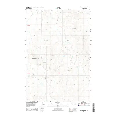
2014 Map of Rattlesnake Ridge
USGS Topo · Published 2014About this map
Rattlesnake Ridge and Sixmile Ridge dominate this corner of Powder River County, Montana, where the high plains break into a network of prominent ridges and drainages. The Powder River clips the northwestern corner of the sheet, fed by several significant watercourses including Crow Cr and Timber Cr. This landscape is defined by its topographic extremes, from the heights of Soldiers Mt and Antelope Butte to the secluded depths of Flintheart Draw.
Find a feature on this map
33 named features on this map. Tap any name to fly to it.
Don’t see what you’re looking for? This feature index may not catch every label — zoom into the map to look around manually.
Map Details
Editions of this 2014 Rattlesnake Ridge Map
This is the sole edition of this map. No revisions or reprints were ever made.
Other maps of this area

1954 · Ekalaka
USGS Topo · 1:250,000

1956 · Ekalaka
USGS Topo · 1:250,000

1958 · Ekalaka
USGS Topo · 1:250,000

1965 · Ekalaka
USGS Topo · 1:250,000

1979 · Deer Creek Buttes
USGS Topo · 1:24,000

1979 · Blacktail Creek SW
USGS Topo · 1:24,000

1979 · Powderville
USGS Topo · 1:24,000

1979 · Rattlesnake Ridge
USGS Topo · 1:24,000
1979 · Oliphant Butte
USGS Topo · 1:24,000

1979 · McKenzie Creek
USGS Topo · 1:24,000