
1937 Map of Rattlesnake
USGS Topo · Published 1937About this map
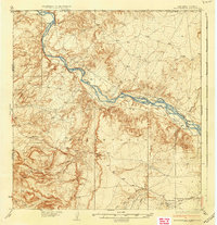
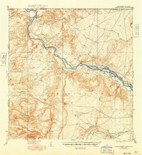
The Navajo Indian Reservation dominates this landscape in the mid-1930s, centered on the braided channels and wide bends of the San Juan River. In the northwest corner, the unique convergence of Colorado, New Mexico, and Arizona is clearly marked at the Four Corners monument. The area is characterized by a sparse settlement pattern connected by early roads, with the community of Rattlesnake situated in the southeast and Bitlabito to the west. Topographical details reveal a complex network of ephemeral drainage systems such as Tohdilo Wash, Red Wash, and Little Ship Rock Wash that carve through the high plateau. The map also captures the confluence where the Mancos River enters from the north, illustrating the vital role of water sources in this arid desert region.
Find a feature on this map
15 named features on this map. Tap any name to fly to it.
Don’t see what you’re looking for? This feature index may not catch every label — zoom into the map to look around manually.
Map Details
Editions of this 1937 Rattlesnake Map
3 editions found
Other maps of this area

1886 · Abajo
USGS Topo · 1:250,000

1889 · Chaco
USGS Topo · 1:250,000

1892 · Abajo
USGS Topo · 1:250,000

1892 · Chaco
USGS Topo · 1:250,000

1892 · Canyon De Chelly
USGS Topo · 1:250,000

1893 · Abajo
USGS Topo · 1:250,000

1927 · Sulphur Spring
USGS Topo · 1:96,000

1928 · Kirtland
USGS Topo · 1:125,000

1932 · Kirtland
USGS Topo · 1:125,000

1934 · Ship Rock
USGS Topo · 1:62,500
Featured Places
- Shiprock Agency
- Gadii'ahi, Shiprock Agency
- Rattlesnake, Shiprock Agency
- San Juan County, NM
- Montezuma County, CO