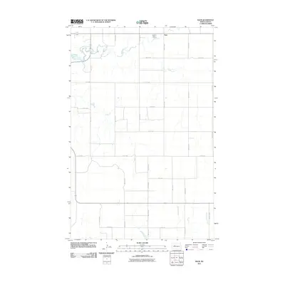
2011 Map of Raub
USGS Topo · Published 2011About this map
Raub anchors the northern portion of this McLean County survey, situated at the junction of several section-line roads. The landscape is defined by the winding course of Deepwater Creek and the southern drainage of Sixmile Creek, which both cut through the agricultural grid. To the northeast of the central settlement, the Queen of Peace Cemetery provides a specific point of reference for family historians and genealogists studying the local community. The terrain is marked by seasonal watercourses such as Buffalo Rock Coulee, while the transportation network relies on the intersection of County Hwy 1 and numbered routes like 22nd St NW. This map reflects the modern rural structure of the North Dakota prairie, where small settlements remain centered around key road intersections and local drainage basins.
Find a feature on this map
19 named features on this map. Tap any name to fly to it.
Don’t see what you’re looking for? This feature index may not catch every label — zoom into the map to look around manually.
Map Details
Editions of this 2011 Raub Map
This is the sole edition of this map. No revisions or reprints were ever made.
Other maps of this area

1953 · Watford City
USGS Topo · 1:250,000

1954 · McClusky
USGS Topo · 1:250,000

1956 · Makoti SW
USGS Topo · 1:24,000

1956 · Blackwater Lake NW
USGS Topo · 1:24,000

1957 · Watford City
USGS Topo · 1:250,000

1958 · McClusky
USGS Topo · 1:250,000

1967 · Watford City
USGS Topo · 1:250,000

1967 · Raub SE
USGS Topo · 1:24,000

1967 · Raub NW
USGS Topo · 1:24,000

1967 · Raub
USGS Topo · 1:24,000