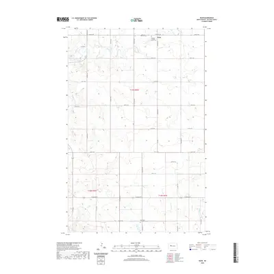
2020 Map of Raub
USGS Topo · Published 2020About this map
Raub anchors the northern portion of this McLean County landscape, sitting amidst a grid of section-line roads such as 23rd St NW and 71st Ave NW. This rural geography is defined by its commemorative landmarks, notably the Bethesda Lutheran Church-Cem and Queen of Peace Cem in the north, and the Immaculate Conception-Cem near the southern border. These sites provide critical points of interest for genealogists tracing families in the Missouri River plateau region. The terrain is marked by winding drainage systems, including the headwaters of Deepwater Cr and Sixmile Cr, which contrast with the rigid agricultural surveying. In the southeast, the Buffalo Rock Coulee carves through the prairie, while Perimeter Rd skirts the lower sections, indicating the proximity to larger regional transit and water management areas.
Find a feature on this map
26 named features on this map. Tap any name to fly to it.
Don’t see what you’re looking for? This feature index may not catch every label — zoom into the map to look around manually.
Map Details
Editions of this 2020 Raub Map
This is the sole edition of this map. No revisions or reprints were ever made.
Other maps of this area

1953 · Watford City
USGS Topo · 1:250,000

1954 · McClusky
USGS Topo · 1:250,000

1956 · Makoti SW
USGS Topo · 1:24,000

1956 · Blackwater Lake NW
USGS Topo · 1:24,000

1957 · Watford City
USGS Topo · 1:250,000

1958 · McClusky
USGS Topo · 1:250,000

1967 · Watford City
USGS Topo · 1:250,000

1967 · Raub SE
USGS Topo · 1:24,000

1967 · Raub NW
USGS Topo · 1:24,000

1967 · Raub
USGS Topo · 1:24,000