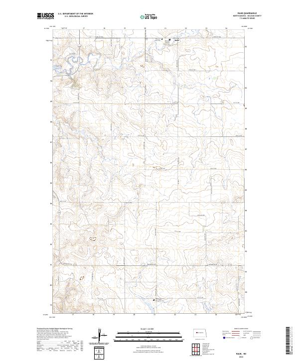
2024 Map of Raub
USGS Topo · Published 2024About this map
Raub serves as the primary landmark in this northern North Dakota landscape, situated at the intersection of a sprawling rural road network. The map reveals a community deeply rooted in its heritage, evidenced by several religious and burial sites including the Bethesda Lutheran Church Cem and Queen of Peace Cem in the north, and the Immaculate Conception Cem further south. These sites, often positioned near section lines and township boundaries like t149n r89w, suggest the legacy of early homesteaders in McLean County. The terrain is defined by glacial drainage patterns, with the winding course of Deepwater Creek and the distinct incision of Buffalo Rock Coulee shaping the prairie. The presence of Perimeter Rd and various numbered section roads highlights the systematic township-and-range surveying that has governed this agricultural region for generations.
Find a feature on this map
28 named features on this map. Tap any name to fly to it.
Don’t see what you’re looking for? This feature index may not catch every label — zoom into the map to look around manually.
Map Details
Editions of this 2024 Raub Map
This is the sole edition of this map. No revisions or reprints were ever made.
Other maps of this area

1953 · Watford City
USGS Topo · 1:250,000

1954 · McClusky
USGS Topo · 1:250,000

1956 · Makoti SW
USGS Topo · 1:24,000

1956 · Blackwater Lake NW
USGS Topo · 1:24,000

1957 · Watford City
USGS Topo · 1:250,000

1958 · McClusky
USGS Topo · 1:250,000

1967 · Watford City
USGS Topo · 1:250,000

1967 · Raub SE
USGS Topo · 1:24,000

1967 · Raub NW
USGS Topo · 1:24,000

1967 · Raub
USGS Topo · 1:24,000