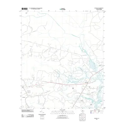
2011 Map of Ravenel
USGS Topo · Published 2011About this map
Ravenel serves as a primary hub in this coastal South Carolina landscape, where residential development and older rural tracts meet the winding waterways of the Lowcountry. The Ravenel Post Office sits at the heart of the community, surrounded by a network of local roads such as Bulow Landing Rd and County Line Rd that navigate the marshy terrain. To the east, the Stono River and Rantowles Creek define the geography, creating a complex system of tidal inlets and marshes that includes Pleasant Point and the Stono Ferry Golf Course. Historic family names and settlements are preserved through features like the Hughes Cemetery and the localities of Berry Hill and Raven Hill. Drainage patterns are clearly visible through the courses of Fishburne Creek, Wallace Creek, and the Mellichamp Branch, illustrating how the land has been managed and settled around these natural barriers.
Find a feature on this map
70 named features on this map. Tap any name to fly to it.
Don’t see what you’re looking for? This feature index may not catch every label — zoom into the map to look around manually.
Map Details
Editions of this 2011 Ravenel Map
This is the sole edition of this map. No revisions or reprints were ever made.
Other maps of this area

1918 · Cottageville
USGS Topo · 1:62,500

1919 · Ladson
USGS Topo · 1:21,120

1919 · Johns Island
USGS Topo · 1:21,120

1919 · Edisto Island
USGS Topo · 1:62,500

1919 · Wadmelaw Island
USGS Topo · 1:62,500

1919 · Legareville
USGS Topo · 1:21,120

1920 · Ravenels
USGS Topo · 1:62,500

1943 · Cottageville
USGS Topo · 1:62,500

1943 · Legareville
USGS Topo · 1:24,000

1943 · Edisto Island
USGS Topo · 1:62,500