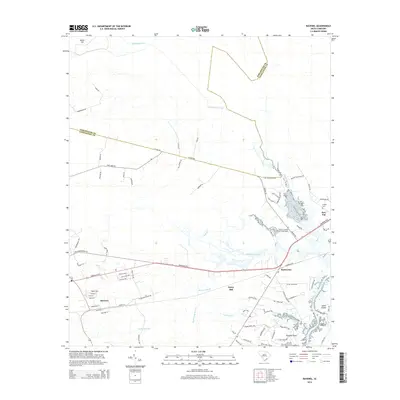
2014 Map of Ravenel
USGS Topo · Published 2014About this map
The Tomb of Colonel William Washington stands as a significant historical landmark in this Lowcountry landscape, situated just north of the Savannah Hwy corridor. The geography is defined by the complex transition between freshwater drainage and tidal marsh, where Wallace Creek and Mellichamp Br flow toward the Stono River and the Intracoastal Waterway near Johns Island. Settlement patterns follow the established transport routes of the Atlantic Coast Line, with the communities of Ravenel and Rantowles serving as focal points for the rural area. Further north, the boundary between Dorchester Co and Charleston Co cuts through a network of roads like Oaks Rd and Moberry Rd, while the eastern portion of the map is marked by the agricultural legacy of Bulow Plantation Rd and the neighborhood of Red Top.
Find a feature on this map
80 named features on this map. Tap any name to fly to it.
Don’t see what you’re looking for? This feature index may not catch every label — zoom into the map to look around manually.
Map Details
Editions of this 2014 Ravenel Map
This is the sole edition of this map. No revisions or reprints were ever made.
Other maps of this area

1918 · Cottageville
USGS Topo · 1:62,500

1919 · Ladson
USGS Topo · 1:21,120

1919 · Johns Island
USGS Topo · 1:21,120

1919 · Edisto Island
USGS Topo · 1:62,500

1919 · Wadmelaw Island
USGS Topo · 1:62,500

1919 · Legareville
USGS Topo · 1:21,120

1920 · Ravenels
USGS Topo · 1:62,500

1943 · Cottageville
USGS Topo · 1:62,500

1943 · Legareville
USGS Topo · 1:24,000

1943 · Edisto Island
USGS Topo · 1:62,500