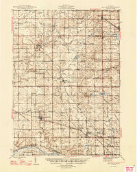
1945 Map of Ravenna
USGS Topo · Published 1947About this map
Coopersville and Ravenna serve as the primary hubs for this rural landscape in the mid-1940s, situated at the crossroads of extensive rail and road networks. The Grand Trunk and Pere Marquette railroads traverse the region, supporting a dense network of farming communities and crossroads settlements such as Conklin, Marne, and Casnovia. The map reveals a highly developed social infrastructure of the era, with dozens of rural schoolhouses like Hoogstraat Sch and Lillie Sch spaced systematically across the townships.
Find a feature on this map
90 named features on this map. Tap any name to fly to it.
Don’t see what you’re looking for? This feature index may not catch every label — zoom into the map to look around manually.
Map Details
Editions of this 1945 Ravenna Map
3 editions found
Other maps of this area

1914 · Grand Rapids
USGS Topo · 1:62,500

1918 · Cedar Springs
USGS Topo · 1:62,500

1929 · Holland
USGS Topo · 1:62,500

1930 · Muskegon
USGS Topo · 1:62,500

1932 · Holland
USGS Topo · 1:62,500

1936 · Muskegon
USGS Topo · 1:62,500

1943 · Cedar Springs
USGS Topo · 1:62,500

1943 · Grand Rapids
USGS Topo · 1:62,500

1945 · Ravenna
USGS Topo · 1:62,500

1954 · Milwaukee
USGS Topo · 1:250,000