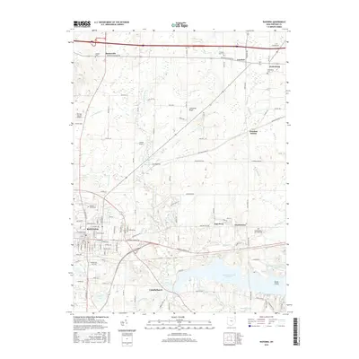
2016 Map of Ravenna
USGS Topo · Published 2016About this map
The city of Ravenna serves as the focal point for this landscape, where early settlement patterns are still visible alongside modern water management infrastructure. To the south, the massive Michael J Kirwan Reservoir dominates the drainage of the West Branch Mahoning River, creating a complex shoreline that includes Goose Island and borders the small community of Campbellsport. The transition from urban grids to rural township life is evident in the surrounding hamlets of Charlestown, Freedom, and Shalersville. Local history is anchored by several burial grounds, including the large Maple Grove Cem in the city and the more remote Drakesburg Cem to the northeast. Between these points, the land rises toward Limestone Ridge, while smaller water bodies like Crystal Lake and Indian Canoe Lake offer a more intimate look at the regional topography.
Find a feature on this map
68 named features on this map. Tap any name to fly to it.
Don’t see what you’re looking for? This feature index may not catch every label — zoom into the map to look around manually.
Map Details
Editions of this 2016 Ravenna Map
This is the sole edition of this map. No revisions or reprints were ever made.
Other maps of this area

1905 · Garrettsville
USGS Topo · 1:62,500

1906 · Kent
USGS Topo · 1:62,500

1906 · Chagrin Falls
USGS Topo · 1:62,500

1906 · Ravenna
USGS Topo · 1:62,500

1907 · Garrettsville
USGS Topo · 1:62,500

1908 · Chagrin Falls
USGS Topo · 1:62,500

1908 · Ravenna
USGS Topo · 1:62,500

1950 · Cleveland
USGS Topo · 1:250,000

1953 · Aurora
USGS Topo · 1:24,000

1956 · Cleveland
USGS Topo · 1:250,000