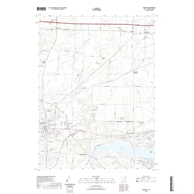
2019 Map of Ravenna
USGS Topo · Published 2019About this map
The Portage County Courthouse stands at the center of Ravenna, anchoring a landscape where historical townships meet modern infrastructure in northeast Ohio. The urban grid transitions into rural hamlets such as Shalersville, Freedom, and Drakesburg, while the massive Michael J Kirwan Reservoir dominates the southeast, creating a complex shoreline that includes Goose Island. This reservoir and the West Branch Mahoning River basin shape the local drainage, including tributaries like Hinkley Cr and Bixon Cr. Genealogists will find several burial grounds across the quadrangle, from Maple Grove Cem in the city to the Charlestown Township Cem and Hillside Cem in the surrounding countryside. The map also captures significant transportation and industrial features, including the Portage County Airport and the sprawling grounds of the Ravenna Arsenal.
Find a feature on this map
78 named features on this map. Tap any name to fly to it.
Don’t see what you’re looking for? This feature index may not catch every label — zoom into the map to look around manually.
Map Details
Editions of this 2019 Ravenna Map
This is the sole edition of this map. No revisions or reprints were ever made.
Other maps of this area

1905 · Garrettsville
USGS Topo · 1:62,500

1906 · Kent
USGS Topo · 1:62,500

1906 · Chagrin Falls
USGS Topo · 1:62,500

1906 · Ravenna
USGS Topo · 1:62,500

1907 · Garrettsville
USGS Topo · 1:62,500

1908 · Chagrin Falls
USGS Topo · 1:62,500

1908 · Ravenna
USGS Topo · 1:62,500

1950 · Cleveland
USGS Topo · 1:250,000

1953 · Aurora
USGS Topo · 1:24,000

1956 · Cleveland
USGS Topo · 1:250,000