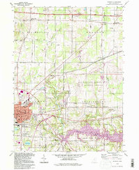
1994 Map of Ravenna
USGS Topo · Published 1997About this map
Ravenna serves as the focal point of this Portage County landscape, displaying a dense network of civic landmarks including the Court House, Library, and Hospital. The city’s residential and commercial growth is flanked by a significant industrial and military presence, most notably the expansive U S Military Reservation Ravenna Arsenal which dominates the eastern portion of the quadrangle. Transport patterns here are defined by the convergence of major infrastructure, from the Ohio Toll Road Turnpike in the north to the Conrail rail lines that once bridged the gaps between surrounding townships like Shalersville and Rootstown.
Find a feature on this map
52 named features on this map. Tap any name to fly to it.
Don’t see what you’re looking for? This feature index may not catch every label — zoom into the map to look around manually.
Map Details
Editions of this 1994 Ravenna Map
This is the sole edition of this map. No revisions or reprints were ever made.
Other maps of this area

1905 · Garrettsville
USGS Topo · 1:62,500

1906 · Kent
USGS Topo · 1:62,500

1906 · Chagrin Falls
USGS Topo · 1:62,500

1906 · Ravenna
USGS Topo · 1:62,500

1907 · Garrettsville
USGS Topo · 1:62,500

1908 · Chagrin Falls
USGS Topo · 1:62,500

1908 · Ravenna
USGS Topo · 1:62,500

1950 · Cleveland
USGS Topo · 1:250,000

1953 · Aurora
USGS Topo · 1:24,000

1956 · Cleveland
USGS Topo · 1:250,000