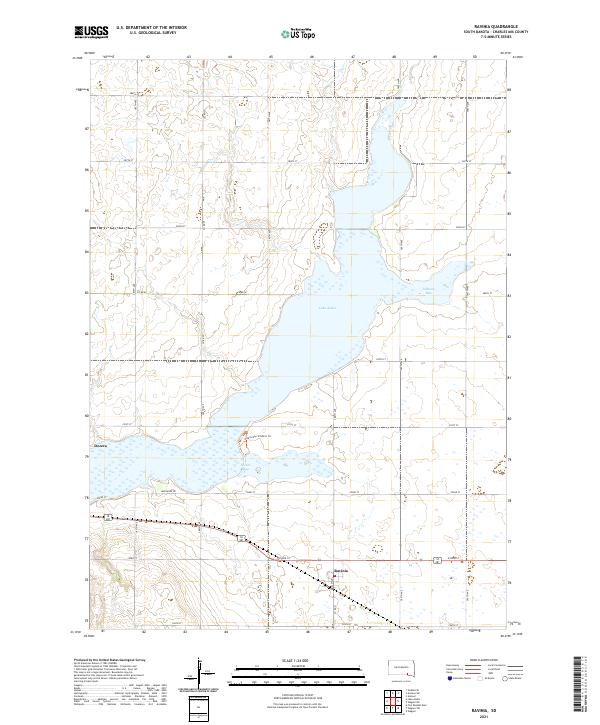
2021 Map of Ravinia
USGS Topo · Published 2021About this map
Ravinia and the small settlement of Dezera anchor this landscape in Charles Mix County, where the sprawling waters of Lake Andes dominate the terrain. This modern survey illustrates the lake's complex shoreline, including Johnson Bay to the northeast and Owens Bay in the south. The area is defined by its transition between organized township sections and the natural curvature of the lake, with Lakeshore Dr and the Owens Bay Wildlife Trl providing access to the water's edge.
Find a feature on this map
21 named features on this map. Tap any name to fly to it.
Don’t see what you’re looking for? This feature index may not catch every label — zoom into the map to look around manually.
Map Details
Editions of this 2021 Ravinia Map
This is the sole edition of this map. No revisions or reprints were ever made.
Other maps of this area

1955 · Mitchell
USGS Topo · 1:250,000

1959 · Mitchell
USGS Topo · 1:250,000

1964 · Wagner NE
USGS Topo · 1:24,000

1964 · Ravinia
USGS Topo · 1:24,000

1964 · Fort Randall Dam
USGS Topo · 1:24,000

1964 · Lake Andes
USGS Topo · 1:24,000

1964 · Wagner
USGS Topo · 1:24,000

1964 · Wagner SW
USGS Topo · 1:24,000
1977 · Wagner
USGS Topo · 1:24,000
1977 · Wagner SW
USGS Topo · 1:24,000
Featured Places
- Ravinia, SD
- Goose Lake Township, SD
- White Swan Township, SD
- Plain Center Township, SD
- Lake View Hutterite Colony, SD