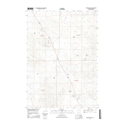
2015 Map of Rawhide School
USGS Topo · Published 2015About this map
Rawhide School stands as a central landmark in this portion of Campbell County, situated along the roadway that traces through the heart of the township boundaries. The landscape is defined by an intricate network of drainages and water sources, including Grant Spring in the northeast and the prominent Rawhide Butte further south. These features reflect a traditional Western ranching geography where named draws and creeks dictate the layout of the land and its utility.
Find a feature on this map
33 named features on this map. Tap any name to fly to it.
Don’t see what you’re looking for? This feature index may not catch every label — zoom into the map to look around manually.
Map Details
Editions of this 2015 Rawhide School Map
This is the sole edition of this map. No revisions or reprints were ever made.
Other maps of this area

1954 · Gillette
USGS Topo · 1:250,000

1955 · Gillette
USGS Topo · 1:250,000

1958 · Gillette
USGS Topo · 1:250,000

1962 · Gillette
USGS Topo · 1:250,000

1971 · Gillette East
USGS Topo · 1:24,000

1971 · Wildcat
USGS Topo · 1:24,000

1971 · Oriva NW
USGS Topo · 1:24,000

1971 · Oriva
USGS Topo · 1:24,000
1971 · Calf Creek
USGS Topo · 1:24,000
1971 · Gillette West
USGS Topo · 1:24,000