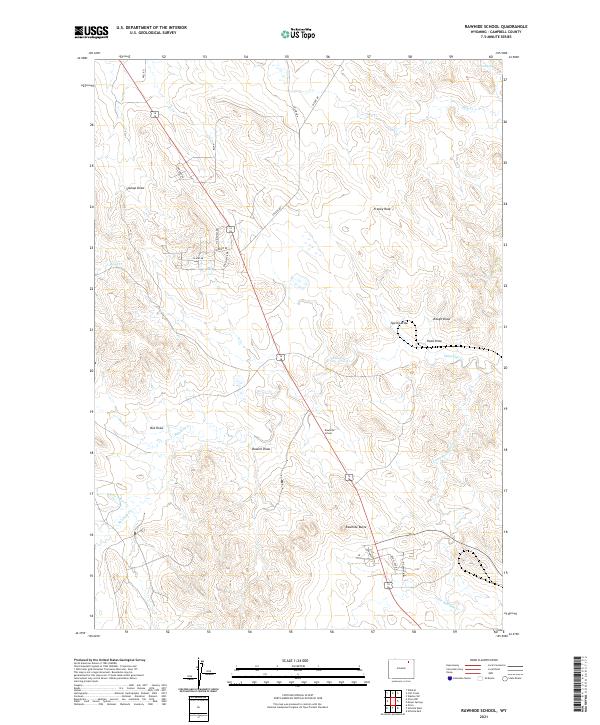
2021 Map of Rawhide School
USGS Topo · Published 2021About this map
Rawhide School stands as a central landmark in this portion of Campbell County, where the high plains are carved by an intricate network of drainages and seasonal draws. The landscape is defined by the headwaters of Rawhide Cr and Little Rawhide Cr, which weave through a terrain punctuated by distinct geological markers like Rawhide Butte and Franey Rock. A series of family-named or descriptive landmarks, such as Soukup Draw, Russell Draw, and Box Draw, reflect a ranching heritage etched into the geography. Residential pockets appear along roads like Island Dr and Ranchette Dr, while the presence of Grant Spring and Nine T-Bar Cr underscores the vital role of water sources in this expansive Wyoming prairie environment.
Find a feature on this map
31 named features on this map. Tap any name to fly to it.
Don’t see what you’re looking for? This feature index may not catch every label — zoom into the map to look around manually.
Map Details
Editions of this 2021 Rawhide School Map
This is the sole edition of this map. No revisions or reprints were ever made.
Other maps of this area

1954 · Gillette
USGS Topo · 1:250,000

1955 · Gillette
USGS Topo · 1:250,000

1958 · Gillette
USGS Topo · 1:250,000

1962 · Gillette
USGS Topo · 1:250,000

1971 · Gillette East
USGS Topo · 1:24,000

1971 · Wildcat
USGS Topo · 1:24,000

1971 · Oriva NW
USGS Topo · 1:24,000

1971 · Oriva
USGS Topo · 1:24,000
1971 · Calf Creek
USGS Topo · 1:24,000
1971 · Gillette West
USGS Topo · 1:24,000