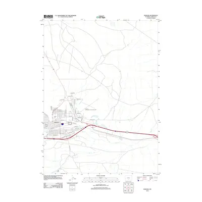
2012 Map of Rawlins
USGS Topo · Published 2012About this map
Rawlins serves as a critical high-desert transit hub in Carbon County, Wyoming, defined by its position along major east-west transportation corridors. The 2012 landscape reveals a grid of residential and industrial streets, such as E Railroad St and Pacific St, which reflect the city's historical development alongside the rail line. To the north and west, the terrain transitions into open rangeland, where the Selfour Ranch stands as a testament to the region's ranching economy. Modern infrastructure is prominent, including the Rawlins Municipal Airport/Harvey Field and the US-287 Byp. Natural watercourses like Sugar Cr and Coal Cr navigate the arid surroundings, while Rawlins Cem provides a focal point for genealogical interest within the city limits. This edition documents the modern footprint of a town built on the logistics of the American West.
Find a feature on this map
48 named features on this map. Tap any name to fly to it.
Don’t see what you’re looking for? This feature index may not catch every label — zoom into the map to look around manually.
Map Details
Editions of this 2012 Rawlins Map
This is the sole edition of this map. No revisions or reprints were ever made.
Other maps of this area

1953 · Sinclair
USGS Topo · 1:24,000

1953 · Rawlins
USGS Topo · 1:24,000

1953 · Lone Haystack Mountain
USGS Topo · 1:24,000

1953 · Rawlins NW
USGS Topo · 1:24,000

1954 · Rawlins
USGS Topo · 1:250,000

1956 · Rawlins Peak
USGS Topo · 1:62,500

1956 · Bridger Pass
USGS Topo · 1:62,500

1956 · Bolten Ranch
USGS Topo · 1:62,500

1958 · Rawlins
USGS Topo · 1:250,000

1962 · Rawlins
USGS Topo · 1:250,000