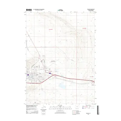
2015 Map of Rawlins
USGS Topo · Published 2015About this map
Rawlins serves as a critical high-desert hub along the Union Pacific corridor, defined by its grid of residential streets and industrial outskirts. In the mid-2010s, the community's layout shows significant northern expansion with residential developments like Aberdeen Blvd and Inverness Blvd situated near the Rawlins Municipal Airport/Harvey Field. To the east, the town of Sinclair stands as a distinct industrial center, linked to the county seat by major transit routes and the winding path of Sugar Cr. The surrounding landscape is dominated by ridges and drainage systems, including Coal Mine Ridge and Hay Gulch, illustrating the transition from the city's urban core to the open sagebrush steppe. Hikers passing through this section of Carbon County encounter the Continental Divide National Scenic Trail, which skirts the western edge of the city before heading into the high country.
Find a feature on this map
67 named features on this map. Tap any name to fly to it.
Don’t see what you’re looking for? This feature index may not catch every label — zoom into the map to look around manually.
Map Details
Editions of this 2015 Rawlins Map
This is the sole edition of this map. No revisions or reprints were ever made.
Other maps of this area

1953 · Sinclair
USGS Topo · 1:24,000

1953 · Rawlins
USGS Topo · 1:24,000

1953 · Lone Haystack Mountain
USGS Topo · 1:24,000

1953 · Rawlins NW
USGS Topo · 1:24,000

1954 · Rawlins
USGS Topo · 1:250,000

1956 · Rawlins Peak
USGS Topo · 1:62,500

1956 · Bridger Pass
USGS Topo · 1:62,500

1956 · Bolten Ranch
USGS Topo · 1:62,500

1958 · Rawlins
USGS Topo · 1:250,000

1962 · Rawlins
USGS Topo · 1:250,000