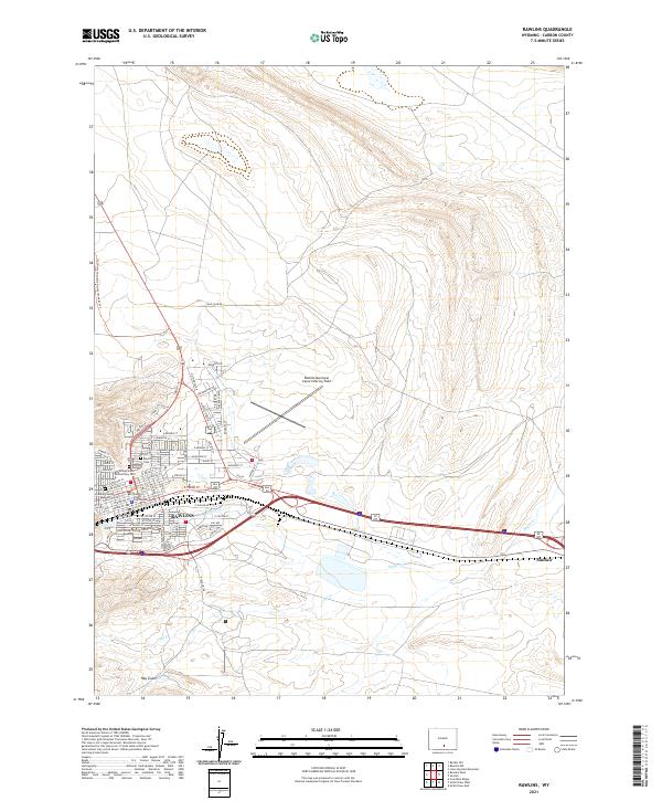
2021 Map of Rawlins
USGS Topo · Published 2021About this map
Rawlins serves as a critical high-desert hub in southern Wyoming, where the historic transportation corridor of the Union Pacific follows the path of the Continental Divide National Scenic Trl. The 2021 landscape is anchored by the civic architecture of the Carbon County Courthouse and the local heritage preserved at the Carbon County Museum. Beyond the city limits, the terrain opens into the arid basins of Hay Gulch, drained by Sugar Cr and Coal Cr. To the east, the industrial character of Sinclair stands out against the sagebrush steppe. Genealogists and local historians can locate specific burial sites at both the Rawlins Cem and the Wyoming State Penitentiary Cem. The map further details the modern municipal layout, including the Rawlins Municipal Airport/Harvey Field and an extensive grid of residential streets like E Cedar St and N Higley Blvd.
Find a feature on this map
56 named features on this map. Tap any name to fly to it.
Don’t see what you’re looking for? This feature index may not catch every label — zoom into the map to look around manually.
Map Details
Editions of this 2021 Rawlins Map
This is the sole edition of this map. No revisions or reprints were ever made.
Other maps of this area

1953 · Sinclair
USGS Topo · 1:24,000

1953 · Rawlins
USGS Topo · 1:24,000

1953 · Lone Haystack Mountain
USGS Topo · 1:24,000

1953 · Rawlins NW
USGS Topo · 1:24,000

1954 · Rawlins
USGS Topo · 1:250,000

1956 · Rawlins Peak
USGS Topo · 1:62,500

1956 · Bridger Pass
USGS Topo · 1:62,500

1956 · Bolten Ranch
USGS Topo · 1:62,500

1958 · Rawlins
USGS Topo · 1:250,000

1962 · Rawlins
USGS Topo · 1:250,000