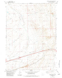
1983 Map of Rawlins Peak SW
USGS Topo · Published 1983About this map
Separation Flats dominates this High Desert landscape, illustrating a late-twentieth-century intersection of essential transportation and energy infrastructure. The southern portion of the map is defined by the Union Pacific rail corridor, running parallel to an Old Railroad Grade and several regional Pipeline routes. These industrial arteries cut across a terrain marked by ephemeral drainage systems like Separation Creek, Separation Draw, and Mahoney Draw.
Find a feature on this map
21 named features on this map. Tap any name to fly to it.
Don’t see what you’re looking for? This feature index may not catch every label — zoom into the map to look around manually.
Map Details
Editions of this 1983 Rawlins Peak SW Map
This is the sole edition of this map. No revisions or reprints were ever made.
Other maps of this area

1954 · Rawlins
USGS Topo · 1:250,000

1956 · Rawlins Peak
USGS Topo · 1:62,500

1956 · Bridger Pass
USGS Topo · 1:62,500

1958 · Rawlins
USGS Topo · 1:250,000

1960 · Buck Draw
USGS Topo · 1:24,000

1962 · Rawlins
USGS Topo · 1:250,000

1966 · Riner
USGS Topo · 1:24,000
1966 · Antelope Spring
USGS Topo · 1:24,000

1967 · Rawlins
USGS Topo · 1:250,000
1983 · Coal Mine Ridge
USGS Topo · 1:24,000