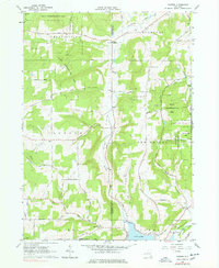
1963 Map of Rawson
USGS Topo · Published 1978About this map
Rawson Valley serves as the central corridor of this survey, connecting the small hamlets of Rawson and Hardy Corners within the rolling highlands of Western New York. The landscape is a patchwork of agricultural clearings and substantial State Reforestation Areas, reflecting mid-century land conservation efforts. To the south, the waters of Cuba Lake are flanked by a Health Camp and the transportation corridor defined by the Erie-Lackawanna Railroad.
Find a feature on this map
53 named features on this map. Tap any name to fly to it.
Don’t see what you’re looking for? This feature index may not catch every label — zoom into the map to look around manually.
Map Details
Editions of this 1963 Rawson Map
2 editions found
Other maps of this area

1898 · Olean
USGS Topo · 1:62,500

1906 · Angelica
USGS Topo · 1:62,500

1924 · Franklinville
USGS Topo · 1:62,500

1925 · Belmont
USGS Topo · 1:62,500

1938 · Olean
USGS Topo · 1:62,500

1939 · Belmont
USGS Topo · 1:62,500

1941 · Angelica
USGS Topo · 1:62,500

1942 · Franklinville
USGS Topo · 1:62,500

1943 · Olean
USGS Topo · 1:62,500

1960 · Buffalo
USGS Topo · 1:250,000