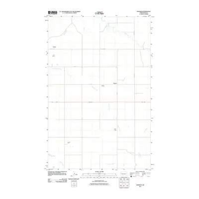
2011 Map of Rawson
USGS Topo · Published 2011About this map
The small community of Rawson sits at the intersection of a grid of section-line roads, representing the enduring agricultural character of McKenzie County. This 2011 survey documents the rural landscape where cattle ranching and farming define the economy, highlighted by the presence of the F James Ranch to the southwest. The geography is shaped by drainage systems including Lonesome Creek, Antelope Creek, and Timber Creek, which cut through the high plains. Distinctive landforms such as Tub Butte and Hay Butte provide vertical relief in an otherwise expansive horizon. For those researching local history or family ties, the map preserves the locations of both the Rawson Cemetery and Alexander Cemetery, which serve as quiet markers of the generations who settled this part of western North Dakota.
Find a feature on this map
14 named features on this map. Tap any name to fly to it.
Don’t see what you’re looking for? This feature index may not catch every label — zoom into the map to look around manually.
Map Details
Editions of this 2011 Rawson Map
This is the sole edition of this map. No revisions or reprints were ever made.
Other maps of this area

1953 · Watford City
USGS Topo · 1:250,000

1957 · Watford City
USGS Topo · 1:250,000

1958 · Stocke Butte
USGS Topo · 1:24,000

1967 · Watford City
USGS Topo · 1:250,000

1972 · Bear Butte
USGS Topo · 1:24,000

1972 · Alexander
USGS Topo · 1:24,000

1972 · Moline School
USGS Topo · 1:24,000

1972 · Rawson
USGS Topo · 1:24,000

1978 · Watford City NW
USGS Topo · 1:24,000

1978 · Arnegard
USGS Topo · 1:24,000