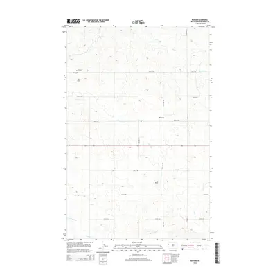
2014 Map of Rawson
USGS Topo · Published 2014About this map
Rawson sits at the heart of this McKenzie County landscape, positioned north of the major east-west thoroughfare of Us-85. The terrain is defined by the drainage patterns of several seasonal watercourses, including Timber Cr in the northeast and the winding path of Lonesome Cr that cuts across the central plains. These creeks navigate a high-prairie environment punctuated by distinct geological elevations such as Tub Butte and Hay Butte. Local history and genealogy researchers will find important landmarks preserved here, specifically Rawson Cem and Alexander Cem, which serve as vital physical records of the area's early residents. The map's grid-like road network, following section lines like 30th St NW and 24th St NW, illustrates the systematic agricultural partitioning of the North Dakota badlands and prairie transition.
Find a feature on this map
16 named features on this map. Tap any name to fly to it.
Don’t see what you’re looking for? This feature index may not catch every label — zoom into the map to look around manually.
Map Details
Editions of this 2014 Rawson Map
This is the sole edition of this map. No revisions or reprints were ever made.
Other maps of this area

1953 · Watford City
USGS Topo · 1:250,000

1957 · Watford City
USGS Topo · 1:250,000

1958 · Stocke Butte
USGS Topo · 1:24,000

1967 · Watford City
USGS Topo · 1:250,000

1972 · Bear Butte
USGS Topo · 1:24,000

1972 · Alexander
USGS Topo · 1:24,000

1972 · Moline School
USGS Topo · 1:24,000

1972 · Rawson
USGS Topo · 1:24,000

1978 · Watford City NW
USGS Topo · 1:24,000

1978 · Arnegard
USGS Topo · 1:24,000