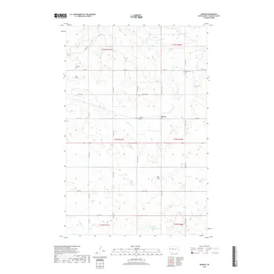
2017 Map of Rawson
USGS Topo · Published 2017About this map
Rawson sits at the heart of this McKenzie County landscape, where the intersection of 1st Ave W and 138th Ave NW marks the community center. This 2017 survey reflects the enduring grid of the Public Land Survey System, with township boundaries like t150n r100w and t150n r101w framing the prairie. The topography is defined by significant drainage networks and isolated rises, notably Tub Butte in the northwest and Hay Butte to the southeast. For those researching local heritage, the map identifies three distinct burial grounds: Rawson Cem near the town site, Alexander Cem to the west, and Timber Creek Cem in the northeast. These landmarks, along with the meandering paths of Lonesome Cr and Antelope Cr, provide a clear picture of the area's rural development and geographic orientation.
Find a feature on this map
28 named features on this map. Tap any name to fly to it.
Don’t see what you’re looking for? This feature index may not catch every label — zoom into the map to look around manually.
Map Details
Editions of this 2017 Rawson Map
This is the sole edition of this map. No revisions or reprints were ever made.
Other maps of this area

1953 · Watford City
USGS Topo · 1:250,000

1957 · Watford City
USGS Topo · 1:250,000

1958 · Stocke Butte
USGS Topo · 1:24,000

1967 · Watford City
USGS Topo · 1:250,000

1972 · Bear Butte
USGS Topo · 1:24,000

1972 · Alexander
USGS Topo · 1:24,000

1972 · Moline School
USGS Topo · 1:24,000

1972 · Rawson
USGS Topo · 1:24,000

1978 · Watford City NW
USGS Topo · 1:24,000

1978 · Arnegard
USGS Topo · 1:24,000