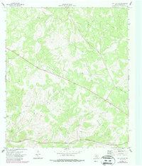
1971 Map of Ray Lake SE
USGS Topo · Published 1987About this map
Old Sonora Road cuts diagonally across this Edwards County landscape, tracing a historical transport corridor through the Texas hill country as it was mapped in the early 1970s and revised in the 1980s. The settlement of Owens sits near the eastern edge of the quadrangle, serving as a focal point in a territory otherwise defined by winding contour lines and sparse infrastructure. This survey captures a moment of transition where traditional ranching routes met mid-century utility developments, evidenced by a long Pipeline and modern communications infrastructure including a Radio Tower and Radio Facility. Local transportation is further marked by a designated Landing Strip and a Roadside Park along the highway, while industrial activity is limited to a small Gravel Pit in the southern reaches of the map.
Find a feature on this map
8 named features on this map. Tap any name to fly to it.
Don’t see what you’re looking for? This feature index may not catch every label — zoom into the map to look around manually.
Map Details
Editions of this 1971 Ray Lake SE Map
2 editions found
Other maps of this area

1893 · Rock Springs
USGS Topo · 1:125,000

1893 · Nueces
USGS Topo · 1:125,000

1896 · Nueces
USGS Topo · 1:125,000

1944 · Indian Creek
USGS Topo · 1:62,500

1947 · Hackberry
USGS Topo · 1:62,500

1954 · Sonora
USGS Topo · 1:250,000

1958 · Sonora
USGS Topo · 1:250,000

1958 · Del Rio
USGS Topo · 1:250,000

1964 · Del Rio
USGS Topo · 1:250,000

1970 · Ray Lake NW
USGS Topo · 1:24,000