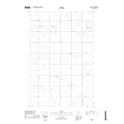
2020 Map of Ray NW
USGS Topo · Published 2020About this map
The Little Muddy River winds through this section of Williams County, defining a landscape of rolling prairie and scattered wetlands. This agricultural region is organized by a precise grid of county roads and avenues, including Co Rd 10 and 118th Ave NW, which serve the rural farmsteads across Townships 157 and 158 North. A significant point of local heritage is the Rainbow Valley Lutheran Cem, located in the northwest corner of the map. The terrain is characterized by numerous small depressions and ponds, typical of the glacial till plains in this part of North Dakota. While sparsely populated, the map reveals the enduring structure of the Public Land Survey System, with section lines and local thoroughfares like 74th St NW and 67th St NW maintaining the area's connectivity and land divisions.
Find a feature on this map
20 named features on this map. Tap any name to fly to it.
Don’t see what you’re looking for? This feature index may not catch every label — zoom into the map to look around manually.
Map Details
Editions of this 2020 Ray NW Map
This is the sole edition of this map. No revisions or reprints were ever made.
Other maps of this area

1911 · Ray
USGS Topo · 1:125,000

1953 · Williston
USGS Topo · 1:250,000

1957 · Williston
USGS Topo · 1:250,000

1974 · Tom Berg Lake
USGS Topo · 1:24,000

1974 · Big Meadow
USGS Topo · 1:24,000

1978 · Corinth
USGS Topo · 1:24,000

1978 · Ray
USGS Topo · 1:24,000

1978 · Ray SE
USGS Topo · 1:24,000

1978 · Temple
USGS Topo · 1:24,000

1978 · Ray NW
USGS Topo · 1:24,000