
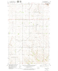
1978 Map of Ray SE
USGS Topo · Published 1979About this map
Golden Valley and Equality townships anchor this landscape in Williams County, reflecting the agricultural and industrial character of the region during the late 1970s. The northern reaches are bisected by the Burlington Northern railroad, a critical link for the transport of grain and resources. The local social fabric is grounded by community landmarks such as multiple Townhall locations and the German Cem, while the winding course of Beaver Creek provides a natural counterpoint to the surveyed grid of the plains.
Find a feature on this map
13 named features on this map. Tap any name to fly to it.
Don’t see what you’re looking for? This feature index may not catch every label — zoom into the map to look around manually.
Map Details
Editions of this 1978 Ray SE Map
This is the sole edition of this map. No revisions or reprints were ever made.
Other maps of this area

1911 · Ray
USGS Topo · 1:125,000

1953 · Williston
USGS Topo · 1:250,000

1957 · Williston
USGS Topo · 1:250,000

1965 · Charlson NW
USGS Topo · 1:24,000

1969 · Cussicks Spring
USGS Topo · 1:24,000

1969 · Red Mike Hill
USGS Topo · 1:24,000

1978 · Ray
USGS Topo · 1:24,000

1978 · Temple
USGS Topo · 1:24,000

1978 · Ray NW
USGS Topo · 1:24,000
1979 · Tioga SW
USGS Topo · 1:24,000